White Brook and Broad Brook Basins Project
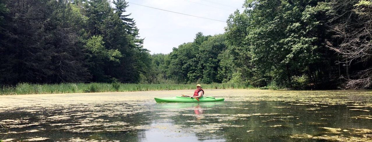
Photo Credit: Stephanie Provo "Approaching Broad Brook"
Overview: Nashawannuck Pond can be viewed as being at the bottom of a large 10.35 square Mile Funnel known as it’s watershed. This means essentially, that when water passes through this zone downward, as a result of rain, a stream, brook, or even a road, the pond, at the bottom of this funnel, is the recipient. The runoff could include, fertilizers, road sand, salt, pollutants, and wildlife excrement to name a few. The most measurable of these is sediment carried to the pond from the White Brook and Broad Brook feeder streams. As a result of this sediment loading, our Pond has shrunk from 50 acres originally, to 35 acres measured back in 1987. The broad brook alone runs along Hendrick St. where there are 7 bridges for motor vehicle traffic. At each of these, road sand is capable of exiting through drain culverts into broad brook. This sediment, which I might add, also has various nutrients attached to each grain which eventually promotes nuisance aquatic plant life to proliferate in the pond. Therefore there is a strong need to halt the downstream flowing sediments which not only feeds plant life, but shrinks the waterbody.
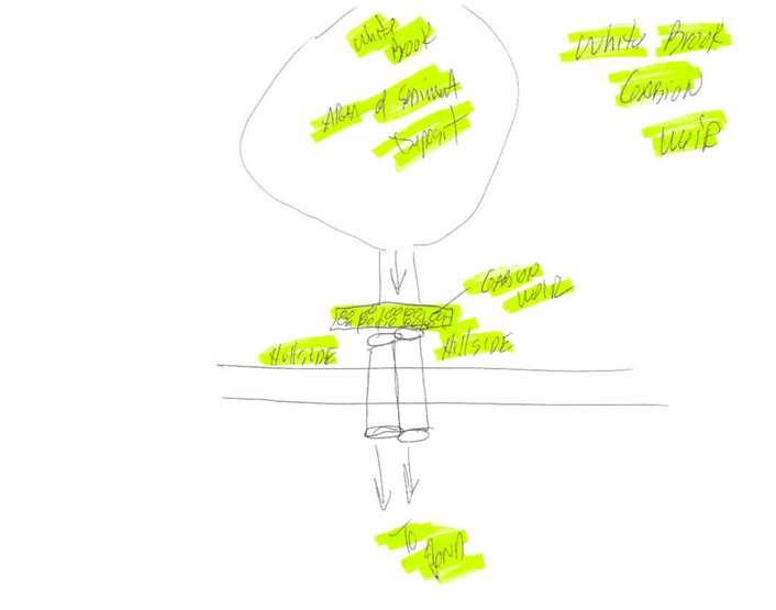
Previous Work: In the late 80’s and early 90’s, the Nashawannuck Pond Steering Committee sought resolution to the sedimentation problem. Two systems were designed, one for White Brook and the other for Broad Brook. The White Brook design was called a Gabion weir. This was a dam-like structure constructed of stone filled baskets which was placed across the brook just before it entered the two large culvert tunnels that pass under the Nonotuck Park road. This device would slow the water flow by pooling water just upstream of it and allow sediments to fall to the bottom and thus held back. Of course, over time, this pool of collected sediments would need to be removed and transported to a containment area to be de-watered.
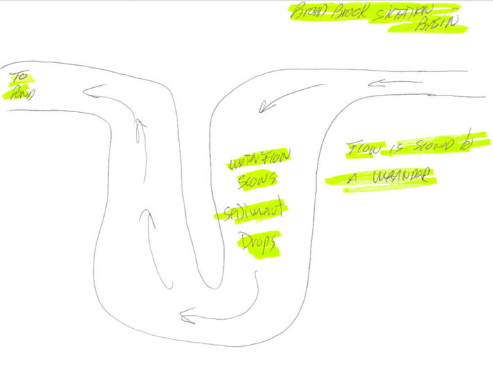
Once the White Brook Weir was in place, we then went on to addressing the more costly and involved Broad Brook situation. Since the Broad Brook, with its much stronger flow and more sediment loading capability, a different design was created. It was called a “Siltation Basin” Here, instead of a dam like structure, water was simply redirected into a 1/3 acre, kidney shaped pool which slowed the water flow significantly to allow the sediment to fall to the bottom of the pool as the water meandered around the basin. As the water exited, it was now free of sediments it was carrying.
As with both streams, the sediment which is held back would need to be cleaned out in order for them to continue functioning properly. This is why these two projects need to be constructed correctly in order to facilitate access and removal of sediment in years to come.
As we stated previously, the Army Corps of Engineers would not proceed with the dredging project in the absence of these two devices. Without sediment withholding, dredging the pond would be an enormously costly short term fix to a problem which would present itself again in the future for another enormous cost.
The project is estimated to cost $301,000. Nashawannuck Pond Committee requested funding from the Community Preservation Act (CPA) as well as from fundraising efforts. In June, 2019 the pond committee made its first presentation of this project. A second meeting was held on July 18, 2019 and the committee received unanimous support from CPA. The work will be done between October and November, 2020. The Easthampton Planning Department has created an informational flyer, including where the dredging will occur, as well as a timeline for the work to be done.
View public outreach flyer
Supporting graphics:
Broad Brook Siltation Basin
White Brook Weir:


